A Day at the Dugout Gulch Botanical Trail
Dugout Gulch Botanical Trail is a moderate trail outside of Beulah, Wyoming in the Black Hills National Forest. It’s a short drive from Spearfish and if you’re looking for a unique trail, that will be less crowded than most, it’s worth the drive from Rapid City. Getting to the trailhead is easy. If you’re coming from Spearfish or Rapid City, hop on I-90 until you get to exit 205 at Beulah. Take a left on Sand Creek Rd and follow this for approximately 8 miles. You will see the trailhead on your left. There is parking at the trailhead, but no restrooms.
There are outhouses at the Sand Creek Recreation Area a couple of miles before the trailhead if you feel the need. Once you get a little ways down Sand Creek Rd, you will lose cell service and will be without service for the majority of the hike. (There is an area about halfway through the loop where I was able to get service for a little bit.)
At the trailhead, you will find a sign explaining the area, but if you are expecting signs along the way describing the vegetation, you will be disappointed. Although, this is a botanical trail, there are no signs along the trail other than trail markers. If you are wanting to know what certain plants are, you can always take photos and then use a plant identifying app later. (I use the Picture This app quite often and it works great!) I probably spend way too much time taking photos of flowers so I can look them up later and identify.
This trail will start out on an old two track road but quickly enter a very thick area with a single track trail. You will follow a creek for the next couple of miles even though you may not always be able to see it due to the thick vegetation. You will cross the water a few times, but you needn’t worry about getting your feet wet. There are very sturdy, well-built wooden bridges to make the crossings easy. You will also find a few wood benches along the creek where you can stop and enjoy the small waterfalls and the running water.
The first couple of miles will leave you feeling almost as though you are in a rainforest. (The fact that it was raining on the day I went could have contributed to this feeling!) At times the greenery almost takes over the trail and you cannot see more than a few feet in front of you. The canyon walls and trees overhead not only offer protection from rain, but keep the trail mostly shaded from sun.
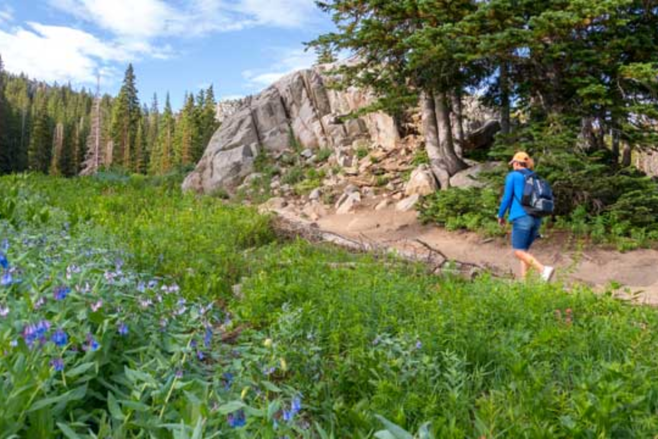
At about 2 ½ miles, the trail will open up into a bit of clearing. This is the start of the loop. You can continue straight or head to the right. I headed straight which had me doing the loop clockwise. There isn’t a lot of elevation gain, but I think there might be a little less if you do the loop counter-clockwise. Although you will still spot plenty of wildflowers along the loop portion, the vegetation is much less thick. This portion of the trail is all single-track rolling through oak and pine trees. There is some poison ivy along the trail so beware.
As you complete the loop, you will come back to the spur section of the trail and head back to the parking lot. Although this trail is a bit long for some, you could very easily tackle the first couple of miles as an out and back and it would still be worth it. If you like a little distance without a lot of elevation gain and love unique plants and wildflowers, this trail is just what you need. For a map and more information click here.